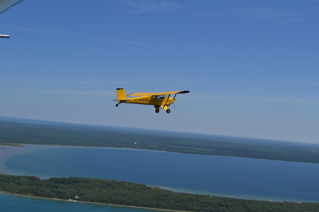
In 2013 Jim Cole (one of our Senior Partners) and his wife Gloria took a trip to Alaska in  their airplane.
Jim travelled with Tom Inglis and his wife Ann from Wingham ON, heading for the COPA convention in Dawson Creek and joining host Bram Tilroe on an Alaska Highway flight to Fairbanks. According to Bram there were 40 aircraft and 78 people registered to make the trip sponsored by COPA.
Throughout the trip Jim communicated to us all through this blog.
It was a great adventure.
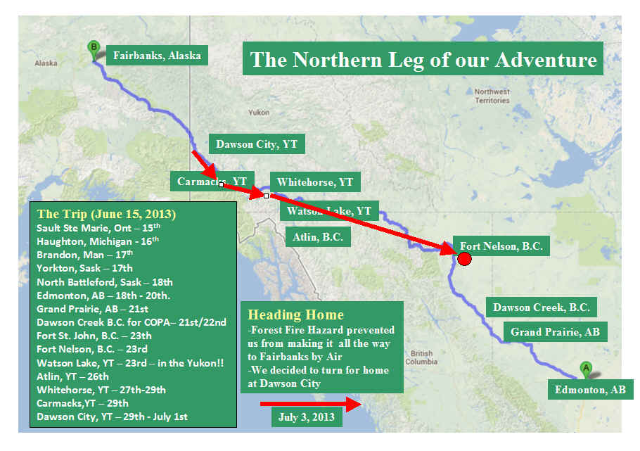
Press Here to see the Overview Map of our Alaska Journey.
or
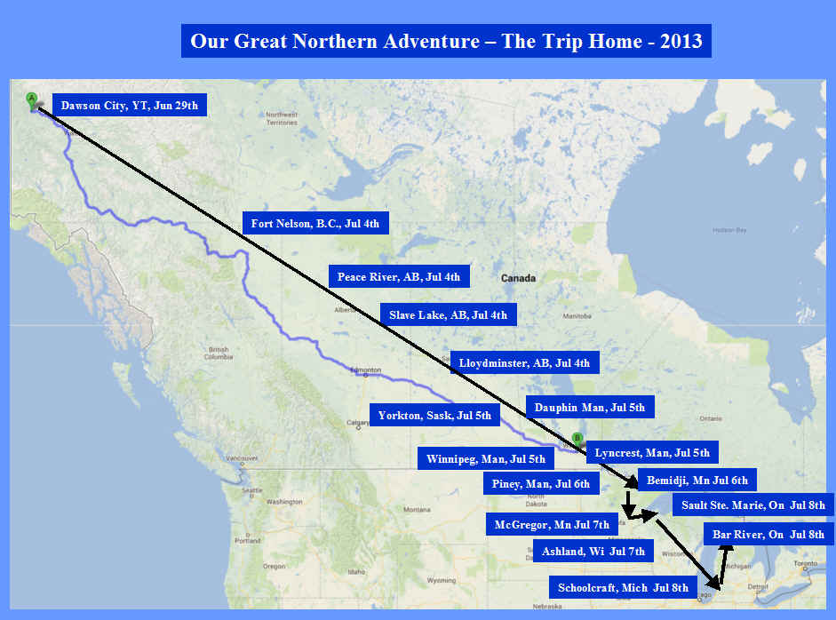
Press Here to see the Overview Map of our Trip Home.
Flying, Fellowship and Fun: COPA Airtour 2013

Press Here to see the earlier part of our Alaska Journey.
![]()

another last test...last one did not go
OK…all set back to medium size photo. The photo in the post may have to be modified to make it fit to 525 in width which is the size of the panel. Just touch the image then go to the text in the post … and then edit the post to change the photo size.

one last test
OK…all set back to medium size photo. The photo in the post may have to be modified to make it fit to 525 in width which is the size of the panel. Just touch the image then go to the text in the post … and then edit the post to change the photo size.

June 17 to July 14th!
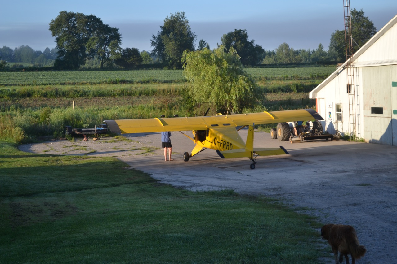
The Rebel is parked at home after a terrific trip. (notice the reception committee of 1) I hope to share our experience in the September/October issue of Canadian Aviator. It will be hard to limit myself to 10 pictures. I want to thank everyone on the trip for making it a wonderful experience. It was a great mix of people, planes, and of course fun! The big question of course is…… what do we do for an encore?? Cheers Jim

alaska: Turning Final-09-Tally-ho!
Well we are now about to land at our home strip, just north east of Alliston, Ontario. A friendly site after being to the Yukon and back, yes it does have a ring to it doesn’t it?
“The Yukon”

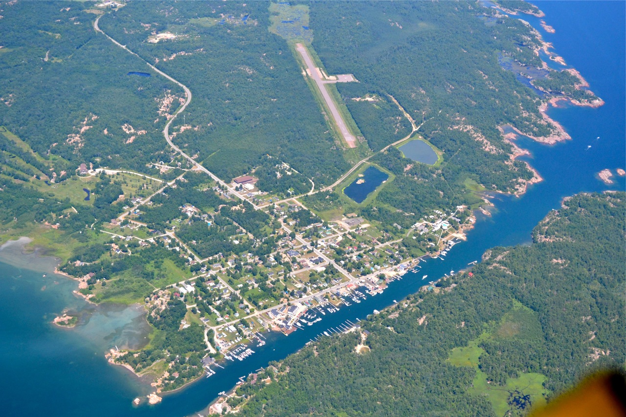
Landing on 08 Nobel
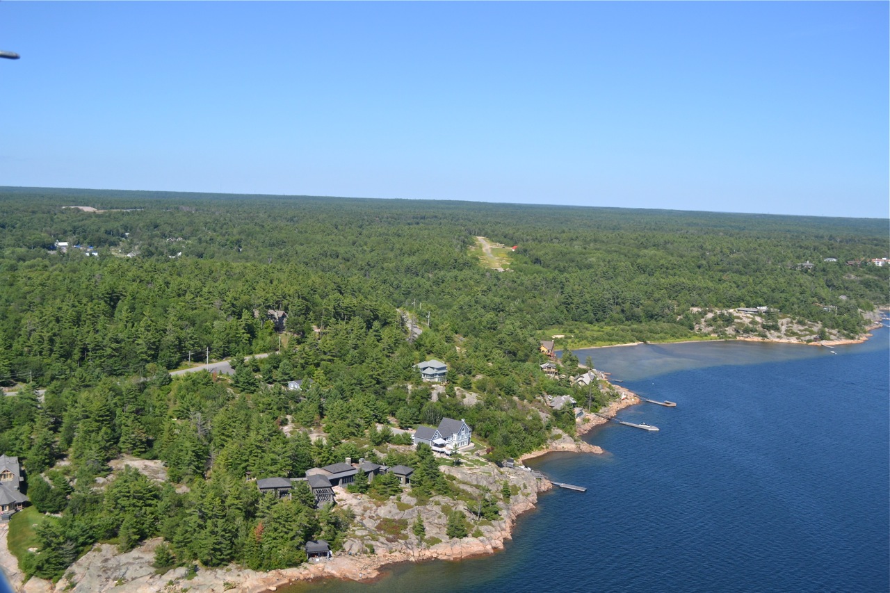
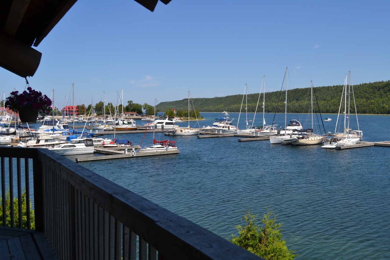
George Ryder has this strip in Nobel and kindly allows me to tie down for the night. It’s about 10 minutes from our lot on Georgian Bay so Gloria picked me up so we could visit the lot on Saturday night after 3 plus weeks away. I must say that the water was warmer than Watson lake.

Over Killarney.
Killarney is on the north shore of Georgian Bay and is a favourite destination for fish and chips. It’s a short walk into town from the airport and quite often you can get a ride. We usually visit a couple times a year, but not this time. I’m at 5500′.

Ken Lehman heads to Guelph.
Ken, in his Rebel, headed home to Guelph, while I headed for Nobel (just north of Parry Sound) on the east side of Georgian Bay.


New Runway at Gore Bay!
I needed to pick up a little more fuel so that I could fly to Parry Sound and then home so we stopped at the Gore Bay airport. We were pleasantly surprised that they had a new runway 23/05, paved in the spring and it was open. This was right into the wind coming off of the bay. Ken and I also borrowed the crew car and headed to downtown, Gore Bay, for lunch. It was such a nice day.

A better view of Bar River!
What a difference 5 days makes in the weather. That terrible weather that we experienced in Southern Ontario over the past week is long gone. Thank you, once again Springer Aerospace for looking after the plane while I was away.

Airport in Tobermory.
Tobermory is where the car and passenger ferry travels over to Manitoulin Island. We climbed to about 4500′ as there is about 15 minutes of islands hopping, as you head across the water that is Georgian Bay on one side and Lake Huron on the other. Beautiful!

Turning Short Final - Wiarton.
On our way up the Bruce Peninsula, we remembered that Wiarton has a great restaurant so we dropped in for Breakfast. Wiarton is the birthplace of the first woman, Eileen Vollick, to hold a pilot’s license (1928) in Canada. Wiarton has a crew car or loaner bicycles that you can sign out.

Collingwood Airport
It was a very pretty morning, but It was too early to get fuel and visit the restaurant in Collingwood so we pressed on.

Weather again!
No not really, it was a very localized fog bank over the river, so it was clear sailing once we were above 500′. Ken is IFR rated, but it wasn’t necessary.

My Ride to Bar River Arrived.
Saturday morning, a good friend, Ken Lehman, arrived at 7:10 am to give me a ride to Bar River in order for me to bring home the Rebel.

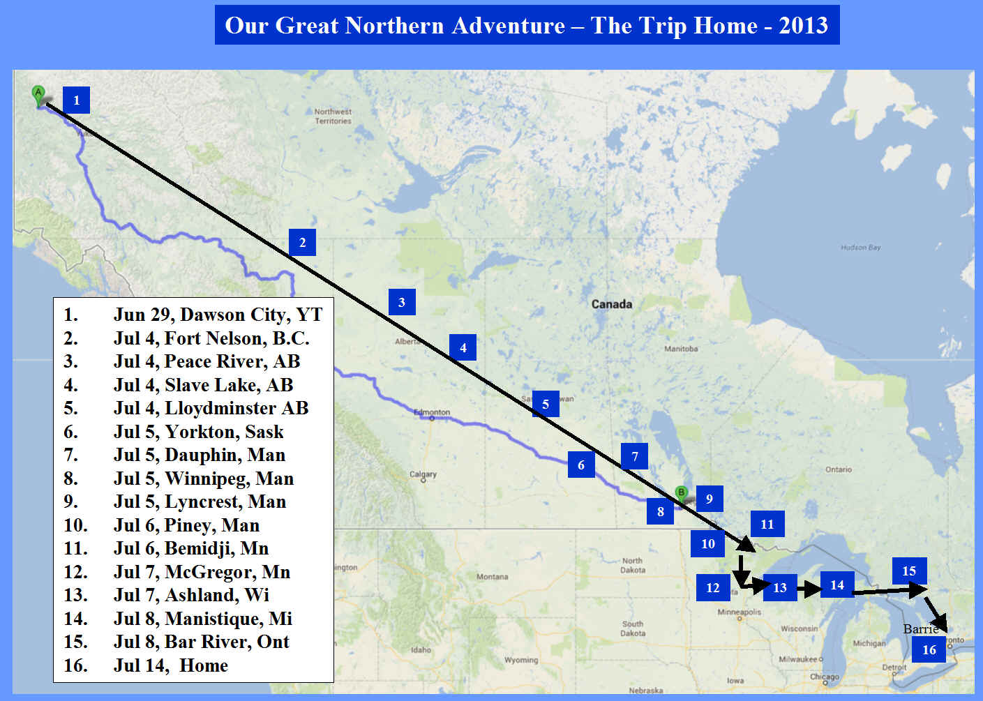
The Trip Home
Web Editor Note:
After some discussion about the Forest Fire situation in Alaska, it was decided that the VFR aircraft would not venture past Dawson City. The Group had taken the train from Dawson City to Skagway Alaska, so technically did make it to Alaska. It was an incredible adventure.
The trip home from Dawson City was pretty direct, but our team encountered some difficult weather conditions. As of Monday, July 8, 2013, Jim and Tom had made it back to Bar River just outside of Sault Ste. Marie Ontario. Because of the horrid weather in Toronto on July 8, it was not possible for them to make it home on Monday as planned.
As you can see below, Tom made it home late Tuesday. Jim had a business meeting in Quebec City on Tuesday, so decided to fly commercial to that meeting then return to Bar River on Saturday (July 13, 2013) to pick up his plane and fly home.

Tom makes it Home!
Tom officially finished the trip by landing at home late on Tuesday! Now my turn, the weather looks good for this weekend so I hope to get back to Bar River to pick up my plane and finish the trip.

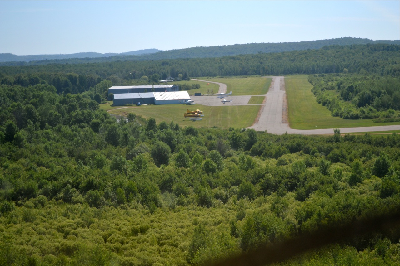
Bar River Hospitality!
We landed unannounced at Bar River and met the folks at Springer Aerospace. They specialize in “Heavy Maintenance” for Twin Otters, Beavers, and other Turbine aircraft. I finally had to give in to the weather! (very tough) But I was running out of time in order to get to Quebec City on Tuesday night for a Wednesday morning business meeting. I decided to tie down the Rebel here for a week or so in order to catch a commercial flight from Sault Ste. Marie to Toronto. I will have to come back and pick up the plane for the final 5 hours!!! Can you imagine the disappointment after about 80 plus hours of flying across the country and back. Jeff Springer was kind enough to drive us back into Sault Ste Marie so I could catch an 8:45 flight , while Tom booked into a hotel to continue in the morning, weather permitting. As we were de-briefing over a beer to part company, I got a text from Air Canada…….my flight to Toronto had been cancelled, because of weather! Go figure!

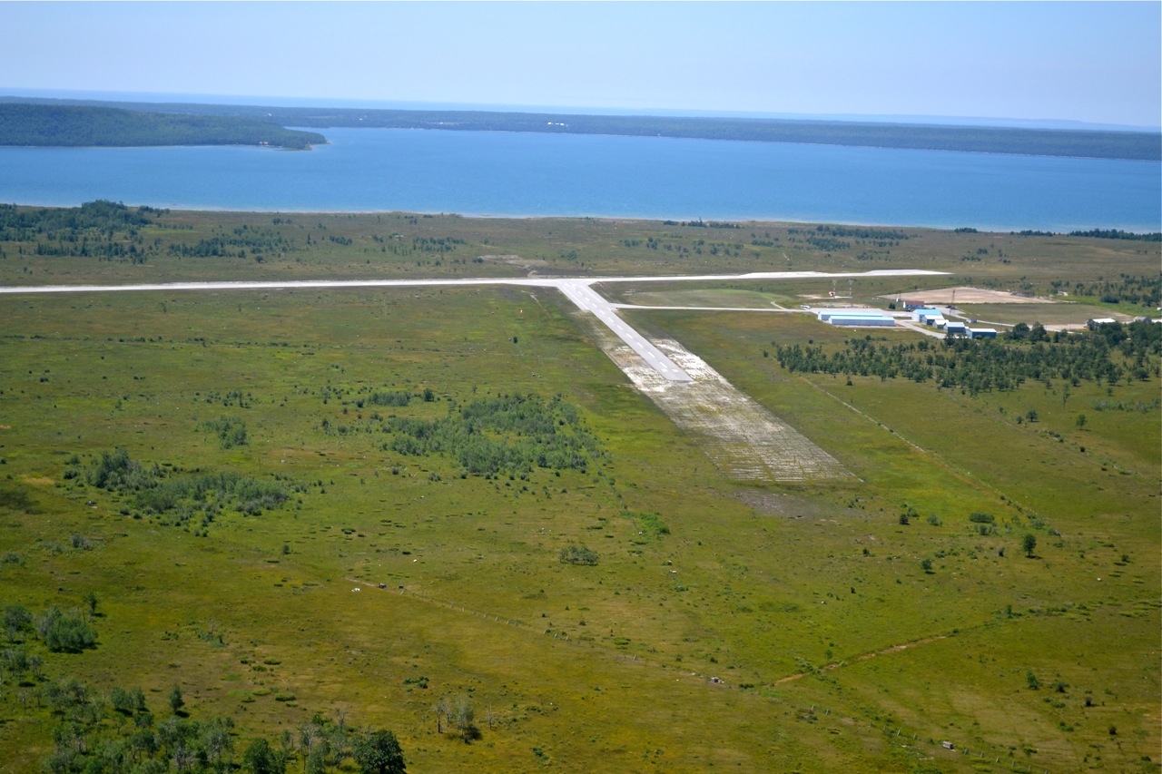
Bar River Airport.
The ceiling just kept coming down as we started towards Killarney, so when we saw Bar River Airport we decided that enough was enough. Here I’m on final for 110.

Lake Freighter and Tom
We’re leaving Sault Ste Marie and the visibility looks OK to the north east. Tom is in the top of frame and of course the lake freighter steaming out to Lake Huron. We are over Sault Ste. Marie, Michigan, with Canada straight ahead and to the left.

Locks at Sault Ste. Marie
We are now about 5 hours from home and with, what we thought was improving weather to the east we punched in Killarney. We anticipated that the ceiling along the shore would be about 1500′ Looked good to start!

Sault Ste. Marie, ON
The ceiling was 1000′ with 5 miles visibility, we were in contact with Toronto Centre and they pasted us off to the Tower. The controller gave me “cleared to land” runway 12, just after I took this picture.

Just can't get past the weather!
We woke up in Manistique (Schoolcraft) to rain, thunder, fog and generally disappointing weather. We had to file with Canpass, US eAPIS, and then file a flight plan in order to fly across the border! – With this weather, it made it very difficult to predict exactly when we would be anywhere – never mind at a point of entry.
We finally decided on Sault Ste. Marie Canada 70 NM to the east.

Turning Final 19 Schoolcraft
Schoolcraft has always been a preferred destination on the way west because there is a motel across the street and you can get a free shuttle to Kewadin Casino, just down the road. We went down for both dinner and breakfast.

One more rain shower!
There’s still lots of thermal activity in the area, so we had to pick a spot between 3 different cells that were in a line. Tom went left and I went right – so for the first time in over 75 hours of flying to the Yukon and back to Schoolcraft, we actually lost sight of each other for an extended period of time.

Reasonable Vis...for a while!
One of the reasons we chose to go the south shore of Lake Superior is because there are a lot more airports that you can use, if you need to divert. This is the Iron County airport in northern Wisconsin – almost directly across Lake Superior from Thunder Bay. Just like Bemidji, they have some scheduled jet traffic, but for the radio, you just broadcast on the 122.8 Unicom. In Bemidji we had a 737 land as we were taxing in to the ramp and both of us said “we need broadcast our intentions more often and be very clear!”

Retired Police Car.
The courtesy car in Ashland is a retired police car – which we think is a good idea. You keep the gas tank full and donate $7 for the use. We put in $1.35! You do need to know where to find the key so you can have a nice lunch in Ashland. There was only one local pilot there washing his Cessna 170.

Final, 02 - Ashland, WI.
You can see what remains of the “Ore Dock”, that was built in 1916 by the Minneapolis, St. Paul and Sault Ste. Marie Railroad and it was 1,850 feet long.

Ashland Wisconsin.
We’ve been to Ashland a few times so it was familiar for us. The famous “Ore Dock” is being torn down…..too bad it was such a landmark. You can see what remains, it’s the biggest piece jutting out into Lake Superior. The air is starting to clear a little.

Fog keeps us grounded.
By staying right at the airport in McGregor, we thought we would be ready to go at first light, but it was not to be. We tried to depart twice before finally deciding that if we went south for about 40 miles, that we could turn east. So on the third try we were able to do a “U” shaped route into Ashland. It was another lesson for us. We picked a string of airports that were VFR and went around the ones that were IFR,

McGregor Hospitality!
We were able to fly the hour and a half to McGregor where again we could get Mogas, use the courtesy car and in this case stay at the airport. For a town of 391, it sure has it’s act together at the airport. It certainly seems to be common practice to have a courtesy car at the airports. The visibility continues to be a challenge.

Turning Final RWY 13 Bemidji
Great airport! We were able to borrow a crew car to head into town to have lunch and wait for the weather to pass. For the first time on this trip we are on the ground waiting for weather, which I think is quite remarkable given the distance traveled…..and the news on the Weather Channel!!

Time to Descend.
We are 20 NM out of Bemidji, with heavy rain between here and Duluth, on the west end of Lake Superior. We need to get through or around this front in order to head along the south shore.

Poking along!
We were above a scattered layer of low cloud that was at about 2000′. More rain up ahead though. Tom’s XM satellite weather on his Garmin. It’s very helpful to let us know if we should be angling left or right to get around showers in our way.

Ready to go in the Rain.
We were inside checking the weather, decided we could go to Bemidji, MN, walked outside and started laughing….it was raining here! We waited about 10 more minutes and took off.

Piney from the Air.
Stopping to clear US customs. You can see the border cut from the bottom right, through the runway and off to the east. Canadian Customs is on the left and US on the right.

Still a lot of Haze
We left Lyncrest, after phoning US Customs at Piney to make an appointment for about 10:30. The showers and haze continue to linger. It was relatively smooth at 1700′. Good thing it’s flat!

Surprise Surprise!
We landed about 6:30 on Friday night and there was hardly any activity at Lyncrest. I sat on a picnic table with my laptop and phone trying to find a hotel and transportation. Tom went down to talk to someone who’s hangar door was open when we taxied in. You can imagine my surprise when he came back with a Jeep!! Wow! Thank you so very much, Murray!!!!

Lyncrest
Lyncrest is on the southeast side of Winnipeg and has a grass runway, mogas, and a very friendly general aviation environment. You can see the perimeter highway in the top of the the frame. One thing about being low and slow is that I can fly with the window open and enjoy the scenery.

Two Rebels over Winnipeg.
Well this certainly was a different view than the other shots I’ve taken over northern BC and the Yukon. Our next instruction from the tower was to turn direct Lyncrest (finally), start our descent after we crossed the river and switch to Lyncrest on 123.2.

Over Winnipeg International
As we went along towards Lyncrest, Winnipeg Terminal passed us on to the Tower. The controller, who was busy with all the jet traffic, first asked us to descend from 3500 to 2500 feet and then as we got just south of the runway asked us to turn left and head for the tower, I asked him to repeat the instruction with a tone that said “you want us to do what?”. Remember Tom is behind me and can’t speak as we are Whiskey Oscar Charlie – Plus One.

Haze over Winnipeg
It was comforting being under the watchful eye of Winnipeg Centre as they followed us over the Southport (Portage Le Prairie) airport and then what we thought would be direct Lyncrest through the south side of the zone. Not!

Dauphin Manitoba
The airports all look so great from the air. This was a short visit into Dauphin in order for us to plan our trip into Winnipeg. We are north west and wanted to go to Lyncrest, which is on the south east side of the Winnipeg control zone. Tom’s, onboard, weather radar helped here as we could plan to miss the showers that were between us and Winnipeg. The haze is building in the distance.

Christening the new Plane.
Roland Jenson and Allan Denesowych get ready to Christen the refurbished plane. There was a crew of about 10 people standing behind us, so I’m sure there was a pretty good hangar party after we left? Every prairie airport that we landed at had a spray operation or two working out of it.

Beautifully Restored Thrush.
Owner, Rolan Jenson, had a big smile on his face after doing the test flight. Yorkton Aircraft spent 2000 man hours restoring the plane and re-powering it with a Walters GE Turbine.

Test Flight.
We were lucky enough to be in Yorkton for the test flight of a fully restored 1977 Thursh spray plane owned by Cloud 9 Airspray.

Yorkton
We knew there was a crew car at Leading Edge Aviation that we could borrow to go get lunch. This is also where the haze started to build and limit visibility more and more all the way into Winnipeg. We used runway 12 again, which is gravel. I’m on downwind.

Staying ahead of the Rain
If though there was a few shower so go around the air was surprisingly calm. This is the North Saskatchewan river.

Turning Base to Final
Most of the airports on the Prairies are a very pretty sight. Here we are landing on runway 12. On the way out we had to skirt the rain off in the distance. All day the rain showers were moving northeast.


Always something to Photograph.
I’m not sure if these are oil or gas wells in northern Saskatchewan but there was a lot of them.

Leaving Lloydminster
We left Lloydminster about 7 am and picked our way through these showers. The skies looked better on the other side. We spent most of the day staying just ahead of the weather, but it was really smooth “hands off” – flying at 3500′

Final 300 (zero) Lloydminster.
The runway was only 1500′ but again, nice to have the Rebel on Grass. Booked a hotel, taxi to town and a good dinner.

Pushed on to Lloydminster.
We had a great flight, “hands-off” from Slave Lake to Lloydminster, at 7500′ and a 10 knot tail wind. We did have to come down under 7000 to get under a couple of the ranges associated with the Cold Lake training area. The wind was 300 at 5 kts so we picked the grass runway you can see at the end of the main one. One problem not in the CFS….it had many Gopher holes, but it was nice to be back on grass.

Final Slave Lake.
Another pretty airport. A short stop to check weather and get a drink. The flying was very smooth now and we wanted to keep going. We found a good tail wind at 7500′

Slave Lake.
Another nice place, with great help from the crew at Conair. The airport is almost in the centre of town and runs into the water.

Leaving the weather behind.
We didn’t stay long in Peace River as you can see just above the wing the thunderstorms and smoke, both moving our way. We wanted to get some separation, but still had time to take a picture of the town of Peace River.


Almost to Peace River.
We went through some smoke, which we left behind as we approached Peace River.

Closer to the Smoke!
We never made it to High Level, as we turned south east and headed to Peace River in order to stay out of the smoke as long as possible.

Unique Landscape!
Lake Zama, in Northern Alberta. You know they said to us that the landscape would be boring on our trip across, but I have to disagree. It’s such a privilege to be able to see Canada from a small plane.

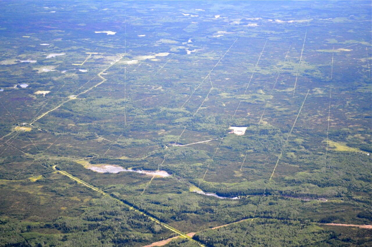
Grid Lines in the Bush.
It would be interesting to find out what all the lines represent. From my point of view they just formed an interesting pattern in the middle of nowhere!

Lines Crisscross the Landscape!
It was amazing to see how many lines there were cut through the bush. They were all over the place and as you can see on the left, there are several lines feeding one station. I hope someone is keeping track?

Northern Alberta
So our chosen route out of Fort Nelson was to High Level, knowing that we wouldn’t be able to follow any roads. It actually turned out not to be an issue as there was pipe lines and lines cut through the forest in all directions.Here’s a Mobile gas well airstrip that shows as abandoned on the chart but could be used in a pinch. Again smoke off in the distance.

Decision Day at Fort Nelson!
The big decision…do we spend the time to head north east to Yellowknife from Fort Nelson or do we start home?? So close and yet so far! We debated right up to the last minute and to help us make the decision we went to see Peter Villers at Villers Air Services in order to gain some local knowledge on the weather and terrain. We really wanted to go to Yellowknife but there was two things that stopped us, smoke from forest fires and a line of thunderstorms. If we had 3 or 4 days for this part of the trip no problem, but we didn’t, so we decided to start the trek home. Great airport and lots of activity. Thank you Peter.

Safely Tied Down!
The Rebels are tied down for the night in Fort Nelson. Note the wind sock between them. You can’t miss it …… straight out! We booked into the Woodlands Inn, who sent a van to pick us up. They were terrific – on the way to the hotel David took us to a couple of stores in Fort Nelson, to find a new charger for my camera battery, plus the food, and the rooms were first class. Thanks David.

Fort Nelson
We’re approaching Fort Nelson – it had been the second day of difficult flying. Certainly the tail wind was a welcome change as we actually reached 105 to 110 knots on a good portion of the trip. The line in the sky on the left is smoke from several fires. We heard from a local pilot that he had to turn around because of 1 mile vis on his way to Fort Simpson.

Out of the Mountains.
It was a welcome scene as we came out of the mountains and looked along the highway towards Fort Nelson.

8000'
I’m up at 8000′ trying to stay out of the turbulence. We again had 20 knot tail or quartering winds with plenty of gust to keep us struggling with the controls. It was unusual to get 900′ a minute updraft and then down drafts.

Tom's not Tired! (yet)
We’re at Watson Lake and Tom is draped over his tail cone in order to hold it down, while the helicopter lands at the fuel tanks.

Some Wet Snow!
We are just about to turn the corner and head down towards Teslin and ran into some brief showers and yes…..some wet snow. The good news was that we turned away from it about 5 minutes later. We had a good tail wind for this leg to Watson Lake but it started to get bumpy again. (by the way my camera battery died so I started using my i-phone)

Following the Highway.
We didn’t necessarily want to fly the same route, but out here there’s not that many choices. H’mmmm clouds in the distance.

Heading East!
We left Whitehorse about 7:30 am so that we could fly in some smoother air, in theory! It was 7 degrees at 5500′

A Maintenance Day!
We spent the day in Whitehorse so that the ladies could catch their flights and we spent our time doing some maintenance on the aircraft. Victor Menkal, a Zenair 701 Builder, was kind enough to give us access to his hangar, his tools, arrange a steak BBQ, and anything else we needed. Being a ‘homebuilder’ he had all the stuff that we would ever need. Thanks Vic!! It sure beat our vision, of where we were going to have to change our oil!

Finally the Airport!
The controller was great in helping us find the airport and turned on the runway lights to make sure we could see it ok. (it’s 18:30) A Super Cub pilot, about 20 minutes before us, had reported severe wind sheer on final so we stayed well above the ravine that you can just see, the edge of, in the bottom of the frame. There was lots of runway so we didn’t have to hurry the landing and after all the bumping around I must say that we greased it! Jim cole Partner Canadian Aviator Magazine jim@canadianaviator.com 1-705-458-9669 “Serving Canada’s aviation Community”

Rain moving in!
We’re about 20 NM out of Whitehorse, so we slipped to the left over Lefarge Lake to run up the valley to the airport. The temperature was 27 degrees in Dawson City and 14 in Whitehorse when we landed. With the rain moving in we were flying painfully slow!

Had to find more fuel!
We had to stop at Carmacks and we’re happy to run into a couple of local pilots that arranged for a little fuel. We wanted to make sure we had extra in case we had to divert, since the forecast for Whitehorse wasn’t great. Again our take off here was a lesson. A 30 knot head wind. It was hard to keep the Rebel on the ground long enough to get enough ground speed to lift off safely. We did a little skipping before finally staying airborne.

Another Fire!
We left Dawson City about 13:30 on July 1st to head back to Whitehorse. We felt it was the best place, in order for our wives to get their flights to Vancouver and Toronto respectively. Apparently there are approximately 50 fires burning between here and Fairbanks. This was the most difficult flying day of the trip so far. It looks OK here, but we are fighting a 20 to 40 knot head wind which of course made it fairly bumpy as well.

River Boat on the Yukon.
This is one of 7 river boats in the paddlewheel graveyard, located just outside Dawson City along the river. When the highway was completed in 1953 these boats became obsolete.

Gold Dredge #4
Some of the group at Dredge #4, these dredges actually floating, digging the gravel out of the way in front of them, processing it, and spitting it out the back, creating piles of tailings. They crawled up the valley – 10′ at a time. Amazing.

Not Just Any Creek!
Believe it or not this…. is the famous Bonanza Creek, where gold was first discovered. It just felt pretty small to me especially since it’s so famous. But then the next picture shows how they began factory mining.

Show Girls!
Some of the cast from Diamond Tooth Girties. We had a great time the previous evening and actually stayed for 2 shows and a little Black Jack. It’s the latest we’ve stay up the whole trip. Sunrise is at 4 am and Sunset at 12:43 – really weird for us.

Canada Day in Dawson!
Dawson City had a small but colourful parade through the town. Mounties of course leading the way.

Bram Addresses the Group.
After a lot of phone calls, discussions with the local contacts in Fairbanks, (including the president of AOPA Alaska), it was decided that most of us would not try and fly VFR into Northway for customs clearance and then on to Fairbanks. A funny weather system, forest fires and smoke, plus the problem with landing at Northway to clear US customs – when there aren’t any facilities or fuel – made the final leg a little dicey for the VFR Pilots. I think 3 IFR planes did go, but we decided to spend an extra day in Dawson City. Although a little disappointed we were happy to spend Canada Day in Dawson!

A renovated Brothel.
Bombay Peggy’s! Yes, this is our home for the next few days and if only the walls could talk….it’s just Great!

Local Help!
Darren Ronaghan, the Regional Airport Manager was there to welcome the group and to help direct us to the fuel pumps and then tie-downs. Again the organization, the contacts, and the experience of COPA’s Bram Tilroe, continued to impress everyone. Cheers Bram!

Turning Final 03 Dawson City.
We came down the valley at the far end of the runway, so this is a great shot of the corner that we came around to find the airport right there. A little side slipping, going base to final, helped us get down to the runway.

Dawson City Airport
We came around a corner in the river valley and there was – the airport! A welcome sight…….and we were already on the downwind for 03. Once you’ve been here, I’m sure it doesn’t feel as tight as it did for us on our first visit in poor visibility. We also had a little higher hill on our right. Just so you know we were in radio contact with the other planes and the tower, not that we knew exactly where everyone was but we were aware.

Down in the Valley!
The last 20 NM was the challenging part. We were down to about 2200′ and in the Klondike river valley. We couldn’t follow the road anymore as it’s up on the hill to our left. There was also at least 6 airplanes, 2 taking off, and some of our group all converging at the same time. We passed a Bonanza going the other way. The GPS sure made it better than it would have been, if we had to do it with a map only.

Stewart Crossing
We went up to 6000′ to be above the first layer of scatter cloud. I turned so I could take this picture, but as you can see by the front off to our left, we soon needed to descend to about 2000′ to get under the overcast.

Following the Klondike Highway!
Here we’re just outside of Pelley Crossing at about 5000′ I was surprised by how it opened up – but not many places to land other than the road. The two routes that people follow are the Yukon River or the highway. We heard the visibility along the river was impaired by a forest fire so it was the highway for us.

On final, Carmacks, YT
Runway 27 in Carmacks. The gravel runways actually work quite well. But note the clouds – we are heading slightly to the right.


Interesting Shapes
We flew over these interesting shapes between Braeburn and Carmacks. I have no idea why some of the water had lime green around the edges and some didn’t, they were certainly visually interesting. (in my humble opinion)

Smoke from a small Fire
In our briefing, they asked us to report any fires that we might see on our route….this one had already been called in. We had just passed Braeburn at 4500′. By the way the elevation at Whitehorse was and 2714′ and we are heading to Dawson City which is 1215′.

Leaving Whitehorse
When we left Whitehorse the control tower gave us a choice of a left or right hand turn out to the north, so I chose left, in order to fly over the city. Yes, that is the Yukon River.
By the way it took us almost 2000′ to get off of the runway with our fully loaded Rebels. Good thing there was 7500′ left!

refuelling beside PM's Plane
We made sure we had full tanks for the flight from Whitehorse to Dawson City in case we had to divert. We had a briefing from Nav Canada and there was some concern about the visibility going into Dawson City (1 mile, rain, and 300′) …..but with a forecast that was better later. Worst case would be camping beside one of the half dozen airports on the way up. None with any facilities.

The Red Onion seemed authentic!
So a couple of old guys did find a place where we felt more at home!!

Downtown Skagway
There’s a reason we wear the shirts. We had to stand out from all the other people that pour off of the Cruise ships. There were two docked on the pier. Now personally, the town feels like a movie set and there’s way too many jewelry stores, which for me are really out of context – gold aside.

Skagway in the distance.
Heading down hill which I’m sure was a lot easier than carrying everything up? Look up the Chilkoot Trail on the internet to see some of the famous pictures.

Yes 1898?
I don’t know why I keep harping on this fact but I just can’t imagine the human effort it took to build the railway. The railway rises 3000′ in 20 miles.


North West Mounted Police Post.
We’re at the summit and starting down to Skagway. You needed to get this Canadian Mounted Police post to continue.

We took soooo Many Pictures!
You will just have to ride the rails yourself to experience the variety of terrain and wonder what it would have been like to carry at least 2000 lbs of supplies up and over the Whitepass before the Canadian Mounties would allow you to enter Canada?? Wow.

Climbing to about 3000'
Obviously not in our planes….The summit is the border between the Yukon and Alaska. A beautiful trip.

Gold Rush Lunch.
Yes a typical lunch, stew, homemade bread, coffee/tea, and apple pie. The room was strangely quiet……everyone was eating. Another great job!

Heading for Bennett
We’re going to stop in Bennett, where in the winter of 1898/99 30,000 stampeders spent the winter building makshift rafts and boats to take them across Lake Bennett and down the Yukon River to the gold fields.

Along the shore of Lake Bennett
The narrow gauge railway was built in 1898 during the Klondike Gold Rush. Our yellow tour shirts certainly stand out.

Riding the Rails!
We spent the day on the Whitepass Yukon Railroad for a 68 mile trip from Carcross, YT to Skagway, Alaska. Once again – great organization, to transport and feed about 60 of us.

Unique Wind Indicator
I don’t think there is a more interesting wind sock than the DC 3 at the Whitehorse airport. It was quite amazing to have it swinging on the pedestal over our heads.

COPA Flight 106
John Faulkner, Victor Menkal, Jean Michel Sauve and Andrea Altherr, did a fine job on the BBQ’s and it was very good of Fireweed Helicopters to let the group use their hangar.

More Hospitality in Whitehorse
There seems to be a common theme emerging on this trip……Hospitality! Yukon – COPA flight 106 did a terrific job. Once again thank you! By the way Sunrise is 4:31 and Sunset is 23:36 PM. Lots of daylight to fly or party.

COPA Alaska in Whitehorse
Here’s the COPA 2013 Planes stacked 2 deep on the edge of the taxi way in Whitehorse. The storm in the background just missed us to the north. Lots of lightning. Some of the group are camping behind the planes others hotel or B&B.

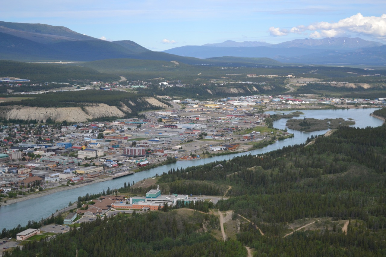
Getting Settled in Whitehorse
The pictures just don’t give you the “wide open” feeling when you’re on the ground looking around.

Final Whitehorse
On final for 13R. Another great reception from the local COPA members. They wanted us to arrive after 4 PM so that they would be off work and able to help us park and get settled.


Following QD
We followed Tom Inglis in QD down over Sloko Lake. This feeds the famous Nakina and Taku rivers and out to the ocean at Juneau.


Just Wow!
It was soooo exciting. Look at the sediment being carved from the peak. There’s an advantage in flying slow – with the window open! (in my humble opinion)

Llewellyn Glacier
We’re at 6000′ and guessing that the clouds are at 7000′. We didn’t want to go too high and get caught in the wedge. Just beautiful.

The toe of Llewellyn Glacier.
I can see a calendar in our future! Even though it wasn’t clear and sunny, the clouds actually gave us a great contrast. Notice some small ice chunks off of the Glacier. The toe has receded 1.7 miles since 1946 and is part of the Juneau ice pack, which is the 5th largest in the Western Hemisphere.


A glacier flight.
Jamie gave us a superb briefing on the routes and things to look out for. Heading down the Torres Channel towards the Llewylly Glacier to see if the cloud layer will allow us to over fly the glacier. We were flying at 4000′ here.

Great Steak - grilled to order!
The crew from the Pine Tree restaurant did a great job of the BBQ. “Mr. Kane” was very happy about the Stanley Cup (had a Patrick Kane shirt on) – he had done some “camp cooking” so our 70 plus wasn’t a problem.

Bram addresses the group!
The local aviation group, lead by Jamie Tait and his wife, really made our visit great! We’re being briefed about our arrival procedures at Whitehorse. One of the big benefits of the tour – is to learn from people that have done it before and to gain some knowledge from the local pilots and ground crew. Thank you Atlin!

Can Hold a Smart Car!
I had no idea that the Short Brothers Aerospace was founded in 1905 and was the worlds first manufacturer of production aircraft. Currently owned by Bombardier and located in Belfast. I can see why Jamie had success in this environment.

Aircraft on the old runway!
A Shorts aircraft on final in Atlin – above some of our tour group. Jamie Tait still has 4 or 5 of the aircraft and loads of parts.

QD leads the way!
Tom and Ann Inglis lead the way in QD, near Teslin at about 4500′ We are about to turn left and climb to 6000 as we head to Surprise Lake and Atlin. Even though the GPS might say 80NM – we never go direct, so you need to plan your fuel accordingly. (this picture is out of order as I made a spelling mistake and the system kicked it out, which is good)

Atlin Lake BC
There’s about 300 full time residence and 600 in the summertime. One restaurant which we kept very busy.
I couldn’t figure out why the lake looked like it had a ‘tide’ but was told by Jamie Tait, that there is about a 9′ swing between winter low and summer high after the snow melt. Jamie also told me that we should consider ourselves still in the Yukon because “the rest of BC doesn’t know they exist!”


Turning Final 18 - Atlin
There’s lots of reflection in the picture, but I thought I would share it anyway.

Atlin Lake BC.
We flew off to the north while we waited for traffic to clear. Atlin – CYSQ – is 2348, therefore circuit height is 3300′. There is one gravel runway 18-36.

Surprise Lake
The good news – no surprise! At 6000′ we were just below the peaks. It was a little bumpy and there was more COPA Air Tour traffic, than we usually encounter, so it was important to stay in radio contact as we funnelled into Atlin.

Alaska: QD leads the Way
Tom and Ann Inglis lead the way in QD, near Teslin at about 4500′ We are about to turn left and climb to 6000 as we head to Surprise Lake and Atlin. Even though the GPS might say 80NM – we never go direct, so you need to plan your fuel accordingly.

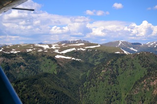
Heading for Some Bigger Mountains!
The Alaska Highway snakes up the valley from Watson Lake. I felt like I was watching a spectacular IMAX movie. The only thing missing was the music score! And it only gets better!

Yes it all fit in the Rebel.
Getting ready to load the Rebel for the flight to Atlin BC. Atlin is back in Northern B.C., just south of the 60th.

A Planning Session
Bram held a planning session in the Gazebo for the trip to Atlin and beyond. Certainly, doing a good briefing before we got into the cockpit allowed us to enjoy the scenery more and of course take pictures.

The Old Hangar at Watson Lake
The hangar is huge. One of the unique float plane trailers in the foreground.

Small Town Friendly!
There is an information centre attached to the site which again is a great visit if you’re interested in the local history, complete with a video.
We found out that the beer store was closed on Monday when we asked (someone needed supplies), one of the kind ladies behind the counter, said “Take my truck” and go to Liaird North, 10 km up the highway and you can have a nice lunch and pick up some “off sales” – so we did! Thank you very much – Buttons!

74,000 Signs!
Started by one soldier from Danville Ohio, this forest of signs has become an amazing tourist stop on the Alaska Highway. I thought I would put one shot of myself in. We were provided these COPA air-tour shirts by Bram, so that we stand out anywhere in town. It actually allows the town to see the impact that the airport and air tour are having on them locally. Great idea!

Jason Enjoys Morning Coffee!
It was the day that we got to visit the sights of Watson Lake. The sun actually rose in the north, I’m facing south. Check the shadows.

Watson Lake Airport Terminal Displays History
One of the pictures is The Flying Trapper, George Dalziel, founder of BC Yukon Air Service. The Terminal is full of great pictures of the 30’s & 40’s. Watson Lake was one of the key airports used by the Lend Lease program with Russia. Certainly worth a couple of hours when visiting Watson Lake.


The Yukon...we're here!

Turning final 09 at Watson Lake Yukon. At last count there was 34 airplanes that have arrived during the course of the day. Lots of history here.
Wow
Just Past Munch Lake – We were flying about 5000′ here. I’m sure some of the locals land on these plateaus.


Great View before Munch Lake
We needed to pay attention here to make sure we made the sharp right turn just after Toad. Apparently there has been many that headed up the wrong valley only to find it being a “dead end” 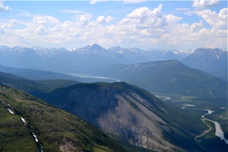
Being Passed by a 185
Just past Summit Lake we were passed by a 185 We used 122.75 for an air to air frequency and 126.7 for general position reporting. 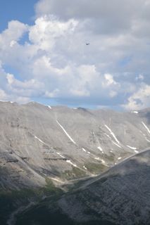
Heading into Higher Terrain
Starting to climb towards Summit Lake and maybe the narrowest part of the trip so far. Good thermals to help us climb to 6000 feet.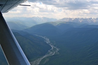
Climbing out of Fort Nelson
You can see Tom off in the distance, it took quite awhile to get the fully loaded Rebels to climb in the hot weather, with full fuel. This next leg was about to get interesting! We would actually encounter the highest elevation on the whole trip at Summit Lake.
Getting Fuel
What a day so far! 3 hours from Dawson Creek to Fort Nelson, but Bram had made arrangements to have someone from the FBO to come in on the Sunday to help refuel the planes. Not sure how many stopped at Fort Nelson, but I there was 5 while we were there. 
Fort Nelson
On Final for 21 at Fort Nelson. Lots of bugs on the wind screen and hot,
but half way to Watson Lake.

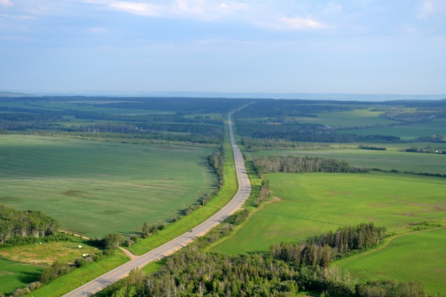
The beginning of the Alaska Highway at 7am
The Start of the Alaska Highway out of Dawson Creek. We left at 7 to get out of the way of the faster planes. The farms and gentle rolling hills were a surprise.